Munich transport map: the maps to download and what they show
The network maps are available as PDFs, as of December 2025, and are not to be confused with the city's transport plan, last updated in March 2021 and July 2025. Plus four open timetable datasets.
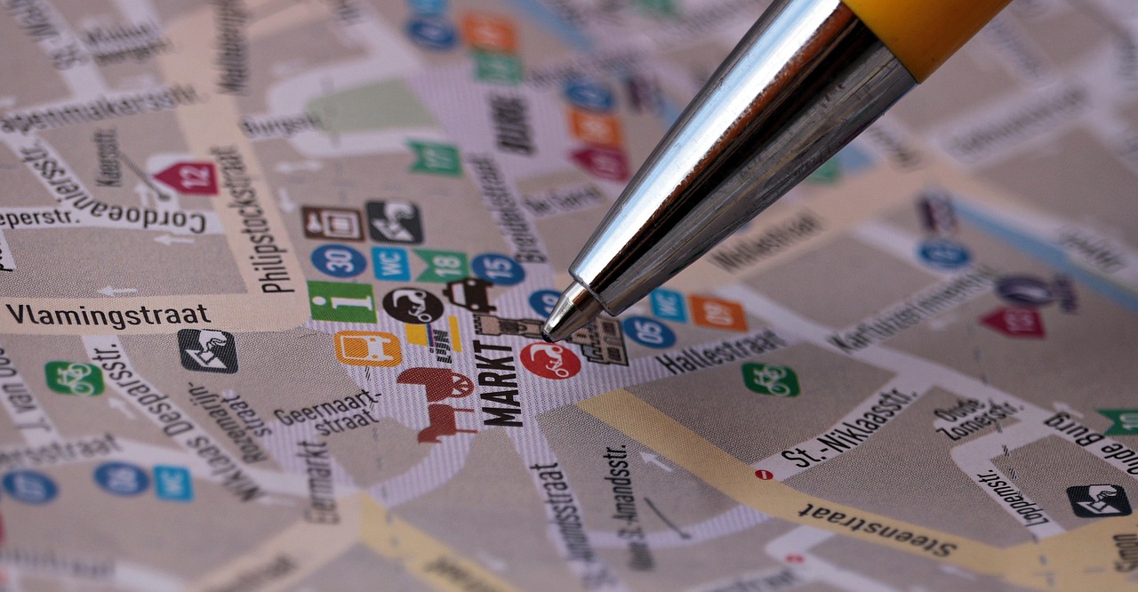
Looking for a Munich transport map, you will run into two German documents with almost the same name. This page separates them and gives the edition date of every document.
In short: the Netzplan (network map) is the map with the lines that you want on your phone. The Nahverkehrsplan is a planning document of the city. Both are public, but not equally easy to get hold of.
The map below was drawn by München365 from OpenStreetMap data: the main lines, their terminus stops and their interchanges. Download it and keep it on your phone.
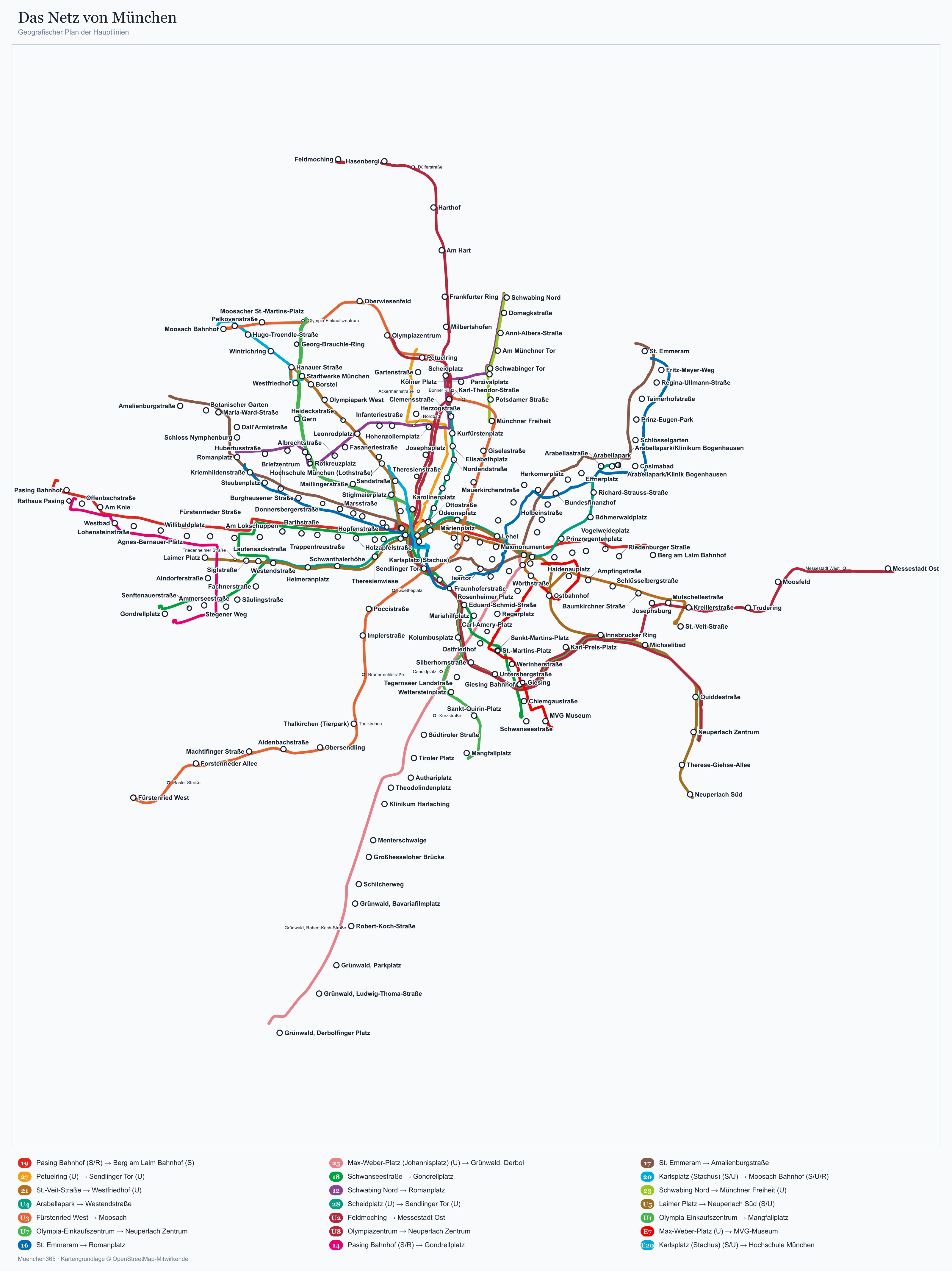
Download the network map (JPG, 975 KB) ↓
The official, complete and current map is the operator's: MVV.
Download the official map: MVV rapid transit network, S-Bahn and U-Bahn 2026 (PDF) ↓
Download the official map: MVG tram network 2026 (PDF) ↓
What is the Nahverkehrsplan, and do you need it?
It is the city's steering document for public transport: targets for coverage, frequency and accessibility, over a period of years. The city council last adopted partial updates in March 2021 and July 2025.
For planning a trip it is useless, and it was never meant for that. What is more remarkable is that the full document with its technical appendices is not offered as a convenient download: the city's page explains the decision and refers you to the specialist departments for the details.
Which maps can you download?
The maps you actually need come from the MVV transport association and the operator MVG. They are available as PDFs, each with a stated edition date.
| Document | Publisher | As of |
|---|---|---|
| MVV full network, zone maps M to 12 | MVV | Timetable 2026 |
| Tram network and night lines map | MVV | Timetable 2026 |
| MVV complete timetable, PDF only | MVV | December 2025 |
| U-Bahn, bus and tram network maps | MVG | 2025 to 2026 |
| Station maps for each stop | MVG | 2025 to 2026 |
The complete timetable exists only as a PDF download and covers every line on the MVV fare. If you want to be able to work offline, download it before you leave, because it is awkward to fetch on a train.
Open timetable data, for anyone who wants to crunch it
For public transport in and around Munich, four open timetable datasets are available in GTFS format, two of them official releases from MVV and MVG.
They let you analyse timetables, routes and stops without an API key: the basis of any journey planner, offline app or map you might build. For travellers this is of no interest; for anyone who wants to build something, it is the real news.
One counterpart is missing, though: the city's open data portal lists 73 datasets, but none on real-time car park occupancy. Timetable data open, parking data not: that is where things stand.
The map does not replace the location: a network map shows how to get everywhere, not how often you will have to ride. Stay in the inner zone and you need half the rides and can skip the zone arithmetic altogether. The places to stay in Munich by location can be checked right next to the line map before you commit.
Compare places to stay by location →Affiliate link: a booking through this link supports the site, at no extra cost to you.Accessible network maps
There are dedicated maps for step-free travel. For each station they show whether there is a lift, a ramp or an escalator, with editions dated between 2022 and 2026.
The figures behind them: more than 80 percent of the 150 stations on the S-Bahn are step-free, and around 90 percent of passengers board without steps. On the tram network, 126 of 148 stops were wheelchair accessible in 2022.
What these maps cannot do: they show the intended state. Whether a lift is out of service right now only appears in the real-time information of the apps, and nobody publishes statistics on how often they fail.
Operating hours, as far as they are published
- First services: between 4:30am and 5am.
- Last U-Bahn on weekdays: around 1am to 1:30am.
- Night lines: every 30 to 60 minutes, with their own map for the 2026 timetable year.
- Public holidays: mostly the Sunday timetable, with no central table of Bavarian public holidays and their effects.
One limit of the sources has to be stated: a line-by-line table of first and last departures does not exist in the generally available material. If you need to plan to the minute, you need the journey planner, not the map.
Where do the sources contradict each other?
Two points cannot be resolved with the public documents, and we would rather say so than favour one side.
U-Bahn and step-free access. A 2026 guidebook describes all 100 stations as step-free with a lift. The city's pages are more cautious and speak of "many" stations with a lift or ramp. We found no official percentage for the U-Bahn.
Night services. The same guidebook describes the U-Bahn as running all night on Friday and Saturday nights. The network's own documents speak of dedicated night lines, not of round-the-clock service on every line. That difference matters on the platform.
Paper or phone?
For preparing at home, the PDF wins: one map, every line, no signal needed. On the day itself the journey planner wins, because only it knows about diversions, cancellations and the status of the lifts.
The compromise that works: save the network map as a PDF on your phone and use the journey planner as well. And carry cash for the ticket machine, because no reliable list of accepted card types exists.
Further reading
What a ride costs and when the day ticket pays off is under tickets and zones. If you are driving, the sums are in the P+R comparison and the city centre prices under parking in Munich. The geography behind the lines: the city map with the districts.
Sources
Sources: muenchenunterwegs.de for the Nahverkehrsplan and its partial updates of March 2021 and July 2025, mvv-muenchen.de for the downloadable maps and timetable media as of December 2025, mvg.de for the network and station maps.
Also: muenchen.de for the accessible network maps, s-bahn-muenchen.de for the S-Bahn accessibility rate, roammate.eu for the details on operating hours and step-free U-Bahn access, which are marked as disputed here.
The number of open timetable datasets comes from the Mobility Database GTFS catalogue, and the finding on the open data portal from opendata.muenchen.de, both checked on 12 September 2026.
Frequently asked questions
Where can you get the Munich network map as a PDF?
What is the difference between the Nahverkehrsplan and the Netzplan?
Is there open timetable data for Munich?
Are all U-Bahn stations in Munich step-free?
Does the U-Bahn in Munich run all night?

Sophie Hartinger
Sophie worked at the front desk of a city-centre hotel for five years and answered the same questions about car parks and the U-Bahn every day. She writes the pages she would have liked to hand to her guests. She checks every price with the operator, never in a guidebook.